

Niosa Mhor [Nisa Mhor]
Good walks are even better shared.
Overview
Niosa Mhor [Nisa Mhor]
Introduction
Nestled in the stunning Scottish Highlands, Niosa Mhor, at an impressive elevation of 497 meters, is classified as a Marilyn, making it a delightful pursuit for hiking enthusiasts and nature lovers. While not the tallest peak, it certainly holds its own with breathtaking views and a unique geological background.
Geology
Niosa Mhor is predominantly composed of ancient Lewisian gneiss, showcasing a rugged landscape that has been sculpted by eons of glacial activity. The area is rich in geological history, with its unique formations attracting both amateur geologists and seasoned experts.
Routes
Niosa Mhor Circuit
One of the most popular routes is the Niosa Mhor Circuit, a moderate circular hike that spans approximately 8 km. The trail meanders through scenic moorland and rocky paths, presenting hikers with plenty of natural beauty along the way. Plan for around 3 hours to enjoy this path, allowing time for photos and, of course, snack breaks!
Summit Features
Upon reaching the summit, you'll be greeted by a modest stone cairn that stands as a testament to those who have come before you. The panorama from this point is simply awe-inspiring, with sweeping vistas of the surrounding Highlands.
Terrain
Expect a charming mix of rocky and grassy paths, while some boggy sections may challenge your footing. A sturdy pair of hiking boots will be your best companion on this journey.
Views
With clear weather, Niosa Mhor rewards its visitors with spectacular sights of nearby peaks. Look out for Ben More and even Ben Nevis in the distance! The landscape also features the stunning Loch Crunachan. The best times to visit for optimal views are indeed late spring or early autumn when the foliage is just right and the air is crisp.
Hazards
While the journey is mostly straightforward, the Highland weather can be unpredictable. It’s advisable to check forecasts and prepare for sudden shifts. Slippery rocks and muddy sections can test even the most avid hikers, so tread carefully.
Access
Nearest Parking
A small parking area near the A85 road offers a starting point for your adventure. It's a popular spot, so come early to secure a place.
Public Transport
For those using public transport, buses run from Callander to Crianlarich, where a quick taxi can take you to the trailhead.
Nearest Town
Crianlarich is the closest hub, complete with basic amenities, shops, and cafes to fuel your hiking escapades.
Facilities
Crianlarich provides the basic necessities for visitors, but if you're planning on a full day, it's wise to pack some provisions to avoid potential hunger pangs on the trail.
History
The name 'Niosa Mhor' translates to 'Great Nisoa', a fitting tribute to its prominence among the surrounding hills. The region is steeped in history, with signs of ancient settlements scattered throughout, providing an interesting backdrop to your hike.
Conclusion
Niosa Mhor may not be the highest peak, but it certainly delivers on stunning views and an enriching hiking experience. With its mix of geological wonder, historical significance, and accessible routes, it’s a must-visit for anyone exploring the Scottish Highlands. So lace up your boots, grab your walking stick, and hit the trail - adventure awaits!
Explore routes near Niosa Mhor [Nisa Mhor]
Public walks starting within 80 km of this hill. Nearby does not mean a route reaches the summit; check its map and access before setting out.
Beautiful private beach walk Isle of Harris
View route
Berneray Community Hall to the beautiful beach
View route
Route planning notes
These notes describe possible approaches, not verified navigable routes or permission to cross land. Check current paths, local access rules and conditions before setting out.
Niosa Mhor Circuit
A circular route that offers a scenic approach to the summit, featuring a mix of paths and open moorland.
Make a day of it, together
Find someone to share the walk with, or organise a day out along a route you like.
Photo Gallery
View all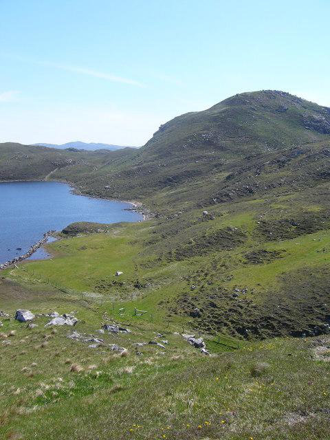 Photo could not load
NB0835 : Niosa Mhor
Iain Macaulay
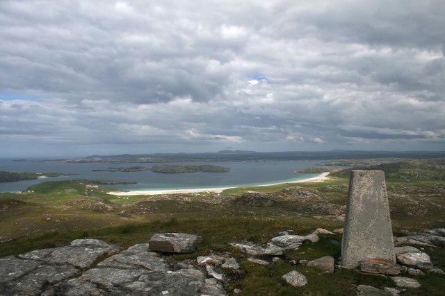 Photo could not load
NB0935 : Trigpoint, Niosa Mhòr, Isle of Lewis
Becky Williamson
Hill facts and local notes
Classifications
Elevation
136m
446 ft
Prominence
130m
Coordinates
58.2114, -6.9566
NB090354
OS Map
13
Explorer: 458
At the Summit
The summit boasts a small stone cairn and offers a panoramic view of the surrounding mountains and valleys, making for a great photo opportunity.
Terrain & Geology
The bedrock primarily consists of ancient Lewisian gneiss, which is some of the oldest rock in the UK. The landscape showcases rugged features shaped by glacial activity, adding to the area's dramatic scenery.
Views & Scenery
From the summit, you can spot the rugged peaks of the surrounding Highlands, including Ben More and Ben Nevis on a clear day. The picturesque landscape of Loch Crunachan is also visible.
History & Heritage
Name Origin
The name 'Niosa Mhor' translates to 'Great Nisoa', reflecting its stature among the surrounding peaks.
Historical Significance
This area is rich in history, with glimpses of ancient settlement remains, and it forms part of the historic landscape of the Scottish Highlands.
Getting There & Facilities
Check current local access restrictions, parking rules and transport timetables before travelling. These notes do not confirm public access to the summit.
Parking
There is a small parking area located near the A85 road, approximately 2 km from the trailhead. It's advisable to arrive early during peak seasons as it can fill quickly.
Public Transport
Bus service operates from Callander to Crianlarich, with a short taxi ride required to reach the trailhead.
Nearby Facilities
Crianlarich has basic facilities including a small shop, cafes, and public toilets. However, it may be wise to bring your own provisions to avoid any disappointment.
Safety Information
Known Hazards
- Watch out for sudden changes in weather; the Highland climate can shift quickly. Be cautious of slippery rocks and muddy patches, especially after rainfall.
General Safety Tips
- Check weather conditions before setting out
- Carry appropriate clothing and equipment
- Let someone know your planned route
- Take a map, compass, and GPS device
- Carry emergency supplies: food, water, first aid kit, torch
Hills
Some common questions about the hills answered
Are there group walks up Niosa Mhor [Nisa Mhor]?
Many walkers use Walkmates to join or organise walks with others. You can check for group walks around Niosa Mhor [Nisa Mhor] through the maps
Are there other walkers around Niosa Mhor [Nisa Mhor]?
Activity varies by location and time, but Walkmates lets you see whether others have shared walks or shown interest in this area. Find other people through the walking friends search walking friends for Niosa Mhor [Nisa Mhor] search or of course create your own walk for Niosa Mhor [Nisa Mhor]
Can I organise a walk to Niosa Mhor [Nisa Mhor]?
Yes. If there aren’t any walks listed already, you can create a walk and make it available for others to join.
If you're signed up to Walkmates, you can create a walk to Niosa Mhor [Nisa Mhor].
How do I find a walk up this hill?
There are often multiple ways to walk this hill, depending on experience and route preference. Walkmates helps you explore walks and routes that others have shared.
Can I suggest a new route up Niosa Mhor [Nisa Mhor]?
Yes. You can suggest or create routes to share with others. Walkmates focuses on the social side of walking, so routes are used to help people organise walks and explore areas together, rather than as detailed navigation tools or route libraries.
Other uses really appreciate knowledgeable walkers sharing their routes. Share your favourite route to Niosa Mhor [Nisa Mhor] here
The is an error or something incorrect about this hill. How do I let you know?
We always strive to keep the information on Walkmates as accurate as possible. If you find an error, please let us know through the contact form and we'll aim to correct it as quickly as possible
Community Discussion
Comments
Location
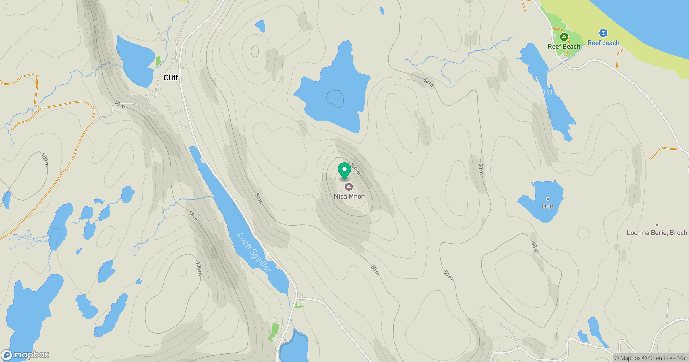
Grid reference: NB090354
View on OpenStreetMapOpens a map in a new tab, centred on the hill.
Hills within 30 km
Straight-line distance, not a walking route or confirmation of access.
An Cliseam [Clisham]
800m
Suaineabhal [Suainaval]
428m
Forsnabhal [Forsnaval]
205m
Sron ri Gaoith
253m
Tarain Mor [Tarain]
411m
No comments yet. Be the first.